MountainWest Pipeline - Informational Postings (Unofficial)

General Information
Owner: The Williams Companies, Inc.
Operator: MountainWest Pipelines Holding Company
Miles of Pipeline 1867
System Capacity: 2.53 Bcf/d
Seasonal Storage: 56
Compressor Stations 16
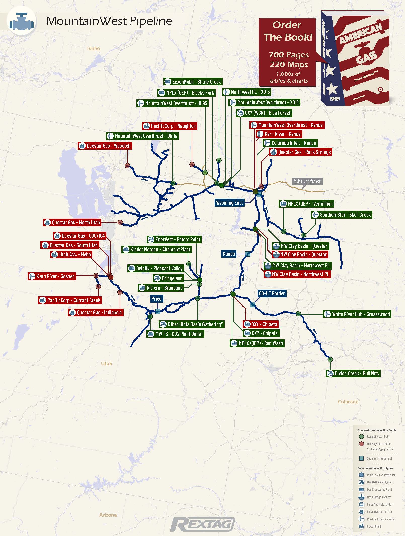
MountainWest Pipeline Pipeline Map
MountainWest Pipeline
Pipeline Description

MountainWest Pipeline, a medium-sized 1,867-mile pipeline located in the Rocky Mountains, serves key natural gas reserves in the Greater Green River, Uinta, and Piceance basins. Owned by The Williams Companies, Inc. and operated by MountainWest Pipelines Holding Company, it operates at more than 50% utilization, serving utility/power and producers sectors. Major clients include Questar Gas Company, Pacificorp, and Concord Energy LLC.

Major Receipt & Delivery Points Charts
Top Receipts Points
(MDth/d)
MW Clay Basin - Questar (Rec)
GSF
OXY - Chipeta (Rec)
GPP
White River Hub - Greasewood
INT
MPLX (QEP) - Red Wash
GPP
Top Delivery Points
(MDth/d)
MW Clay Basin - Northwest PL (Del)
INT
Questar Gas - Wasatch
LDC
MountainWest Overthrust - Kanda
INT
Kern River - Goshen
INT
Major Receipt & Delivery Points Tables
Pick a Date: February 1, 2024 Login to DataLink to choose more dates
Top Receipts Points
(MDth/d)
Top Delivery Points
(MDth/d)

Gas Pipeline / Storage Facility - Informational Postings (Unofficial)

General Information

Our informational Postings section covers all active interstate regulated (FERC) gas pipelines and storage facilities. Select a Pipeline or Storage Facility from the list below to view details such as a pipeline map showing meter points (interconnection points), daily gas flows for major points with historical volumes and a short description of the pipeline system, its utilization, and customers.